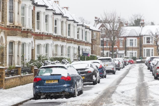
After another cold night on Friday night, with ice in many places, an area of low pressure will move into the UK from the southwest on Saturday. Initially this will bring rain to South West England before turning increasingly to snow as it bumps into the cold air over the UK through the late afternoon and through the evening into Sunday.
Snow warning
Snow will accumulate through the evening and into Sunday before turning to rain in central and southern areas of England. It will continue to fall as snow in northern England, where some significant accumulations could develop through Sunday. As the snow turns to rain further south, and especially over Wales, there is a risk of freezing rain, a dangerous weather phenomenon which sees rain freezing instantly when it reaches the surface causing dangerous icy conditions.
⚠️⚠️ Amber weather warning issued ⚠️⚠️
Snow across northern England
Saturday 2100 – Sunday 2359
Latest info 👉 https://t.co/QwDLMfRBfs
Stay #WeatherAware ⚠️ pic.twitter.com/v2MKvd2nvJ
— Met Office (@metoffice) January 3, 2025
Met Office Chief Forecaster Jason Kelly, said: “This weekend will bring a range of weather hazards to the UK, notable snow accumulations, freezing rain, ice and heavy rain as well as some gusty conditions.
“We have issued a number of severe weather warnings, including Amber warnings for snow and ice in parts of England and Wales. Some significant accumulations of snow are possible across parts of Wales, the Midlands and northern England in particular, where 5 cm or more could accumulate fairly widely, with as much as 20-30 cm over high ground of mid and north Wales and potentially 30-40 cm over parts of the Pennines. This, accompanied by strengthening winds, may lead to drifting of lying snow.”
⚠️⚠️ Amber weather warning issued ⚠️⚠️
Snow and ice across parts of central England and Wales
Saturday 1800 – Sunday 1200
Latest info 👉 https://t.co/QwDLMfRBfs
Stay #WeatherAware ⚠️ pic.twitter.com/TLvSrtSC1Z
— Met Office (@metoffice) January 3, 2025
Freezing rain brings a dangerous ice risk
As the milder air moves northwards, snow may turn to a spell of freezing rain for a time. Jason continued: “There is a risk of freezing rain across parts of the Midlands and northern England, but especially Wales, adding to the risk of ice and leading to some treacherous conditions in places. As the supercooled rain droplets hit the surface they instantly freeze, covering everything in a layer of ice, making it extremely dangerous.”
National Highways Severe Weather Resilience Manager, Darren Clark, said: “If you are travelling this weekend, keep your distance and reduce your speed. Gritters will be out treating our roads around the clock when ice or snow is forecast, but it is still important to drive to the conditions.
“Even in conditions that seem normal and where the snow is not settling you could always experience slippery conditions.
“Drivers should plan their journeys, check their vehicles, monitor weather reports and pack a snow kit of blankets, food, water and a shovel.”
Snow thaw brings further flood risk
As the milder air moves in after the snow, a fairly rapid thaw of lying snow is possible later on Sunday, although exactly how far north the rapid thaw will reach remains uncertain at this stage. This may bring an additional flood risk as the snow melt enters already saturated catchments. Keep up to date with your flood risk through the Environment Agency in England, SEPA in Scotland, NRW in Wales and Department for Infrastructure in Northern Ireland.
Ben Lukey, Flood Duty Manager at the Environment Agency, said: “Combined rainfall, snow and snowmelt over the weekend means minor river and surface water flooding impacts are possible in parts of England on Sunday and Monday.
“Environment Agency teams continue to be out on the ground, operating flood defences, taking action to reduce the impact of flooding, issuing flood warnings and supporting those communities affected.
“We urge people to remain vigilant over the weekend and advise anyone travelling to be especially careful and urge people to stay away from swollen rivers and not to drive through flood water as just 30cm of flowing water is enough to move your car.
“People should search ‘check my flood risk’, sign up for free flood warnings, and keep up to date with the latest situation at @EnvAgency on X.”
Further ahead
After the brief incursion of milder air over the weekend, colder conditions are set to develop widely across the UK into next week.
Deputy Chief Forecaster Dan Holley, said: “The system bringing this weekend’s snow will move away to the east by Monday, allowing a cold a northerly flow to become established again for much of next week. This will bring further snow showers to northern Scotland in particular, but possibly to some other areas, especially near western coasts, with a fair amount of dry and bright weather elsewhere.
Temperatures will remain below average, with widespread frost and the risk of ice at times. Some areas, especially in the north, may struggle to get above freezing for several days. It is possible further weather warnings will be issued for the start of next week, so it’s advisable to stay up to date with the forecast.”
You can find the latest forecast on our website, on YouTube, by following us on X and Facebook, as well as on our mobile app which is available for iPhone from the App store and for Android from the Google Play store.


